WW2 AERIAL RECON STUDIES
Western Front
The U.S. Army Roer River Offensive, November 1944
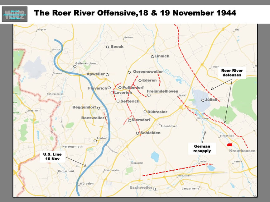
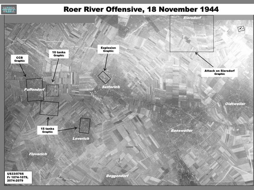
Elements of the U.S. Army 2nd Armored Division, 29th Infantry Division and German 9th Panzer Division were imaged by American reconnaissance on 18 November 1944 in the final stages of the Siegfried Line Campaign. Begun two days before, the Roer River Offensive had brought the units into contact at the villages of Apweiler, Gereonsweiler and Setterich, where the U.S. advance had stalled. Constant rain over the Roer plain created muddy, nearly impassable fields and limiting air support. November 18th was one of only two rain-free days during the month and thus the sortie was able to reveal evidence of fighting and the layout of defenses over nearly the entire area (Map, Graphic). Limited coverage on 19 November showed continuing operations around Siersdorf.
The German defenses encountered by the American units consisted of village strongpoints connected by a network of trenching in front of the main defensive line centered on Jülich on Roer River (Map). The most formidable defense was a five-kilometer-long anti-tank ditch. The strongest defenses were found at Gereonsweiler, where armor from the 9th Panzer Division could cover approaches from the west and south.
North Sector
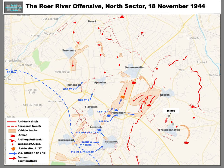
The American 2nd Armored and 29th Infantry Divisions were selected to operate in northern and southern sectors, respectively. In the north, one 2nd Armored Division combat command (CCB) composed of two armor battalions and armored infantry from the 66th Armored Regiment, comprised two task forces (TF 1 and TF2), plus a third,TF X, formed from the 67th Armored Regiment. TF 1 was tasked with tasked against Gereonsweiler while the other two were to take Apweiler, 1.5 km to the west-southwest (Map, Graphic).
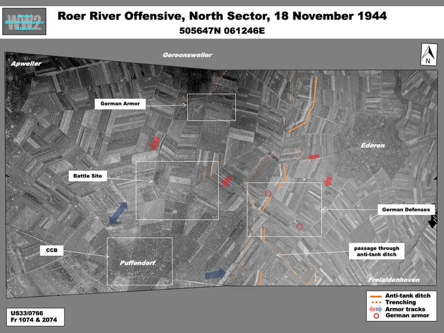
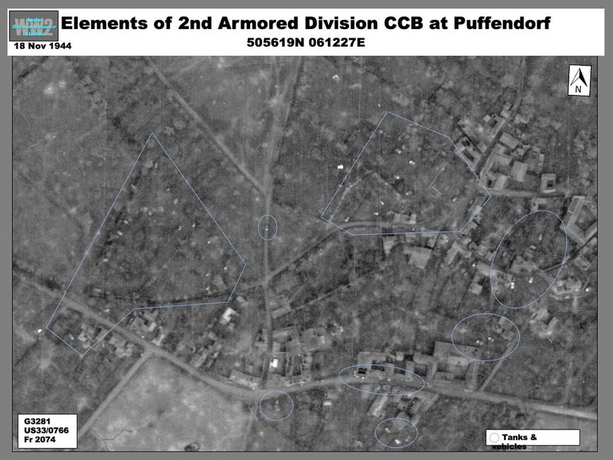
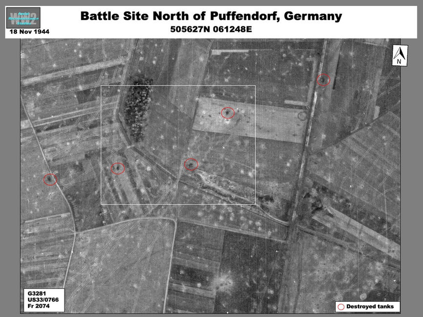
Coverage from 18 November showed elements of CCB TF 1 (including some possibly from CCA) with about 30 tanks parked inside Puffendorf. Task Force 1 had been forced back to the village after a German counterattack in the early morning of the previous day (Graphic). German tanks caught TF 1 unprepared 1 in a field 600 north of Puffendorf and in the ensuing battle the Americans lost about 35 medium tanks destroyed or damaged, plus a similar number of light tanks. At least six destroyed tanks (five shown) remained at the battle site (Graphic).
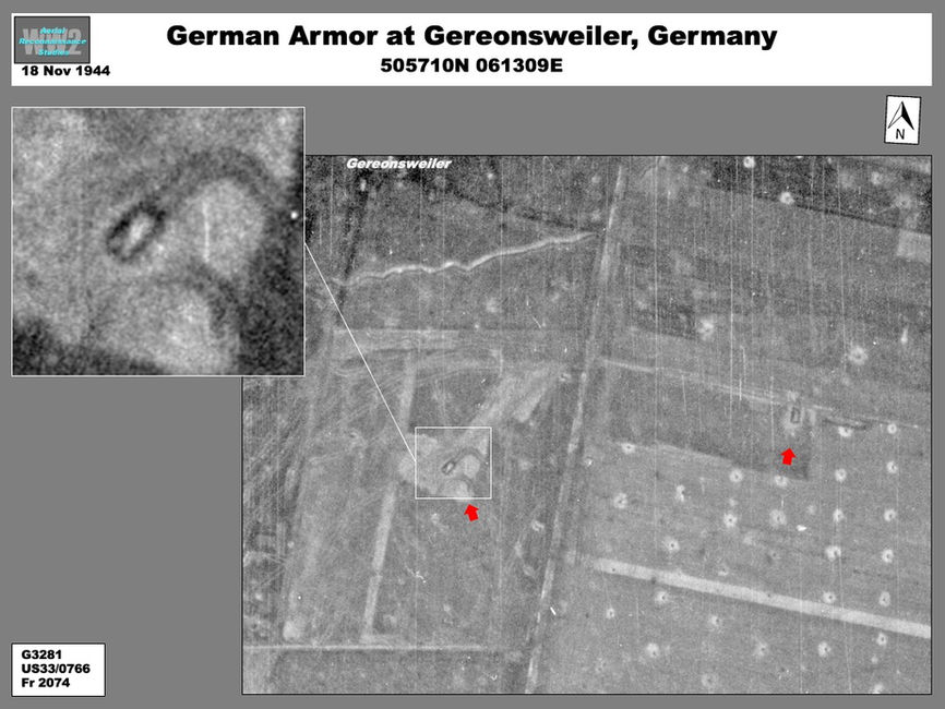
At Gereonsweiler, 1.6 km north Puffendorf, two German tanks were deployed in key positions on the outskirts of the village (Graphic) Elsewhere, a total of three other German armored vehicles were deployed outside Beeck and Freialdenhoven.
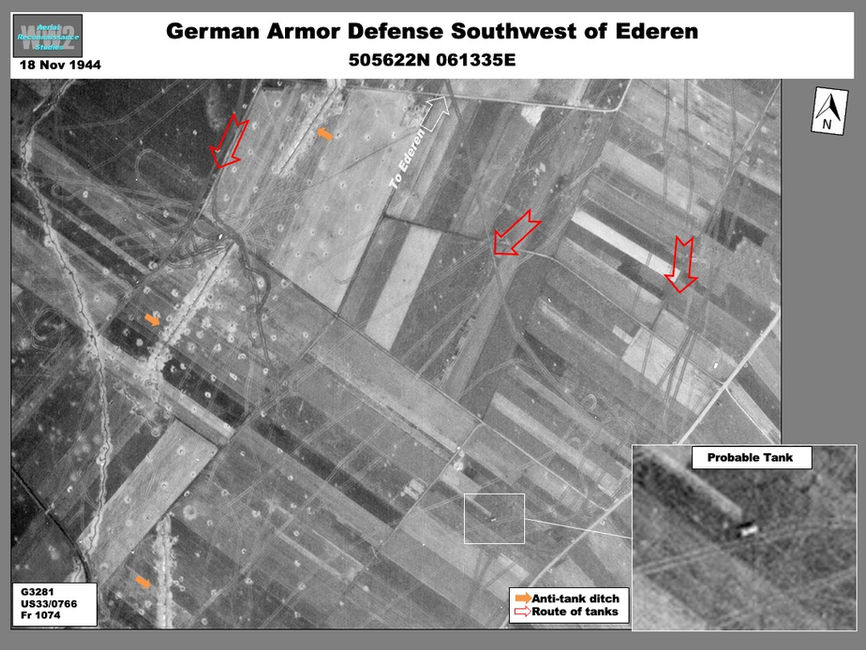
On 17 November elements of CCA were ordered to bypass Gereonsweiler by moving northeast from Puffendorf to Ederen. A key objective was to establish a crossing of the tank ditch. This attack quickly failed. An analysis of tracks originating from Ederen along and through the ditch indicates several German tanks responded to the latter attack (Graphic). One probable German tank remained in the field.
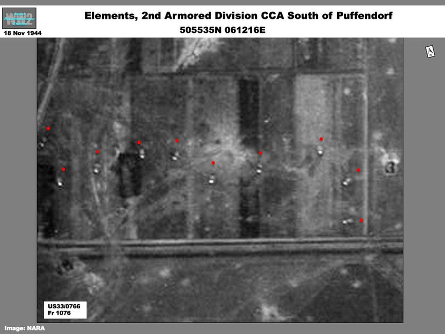
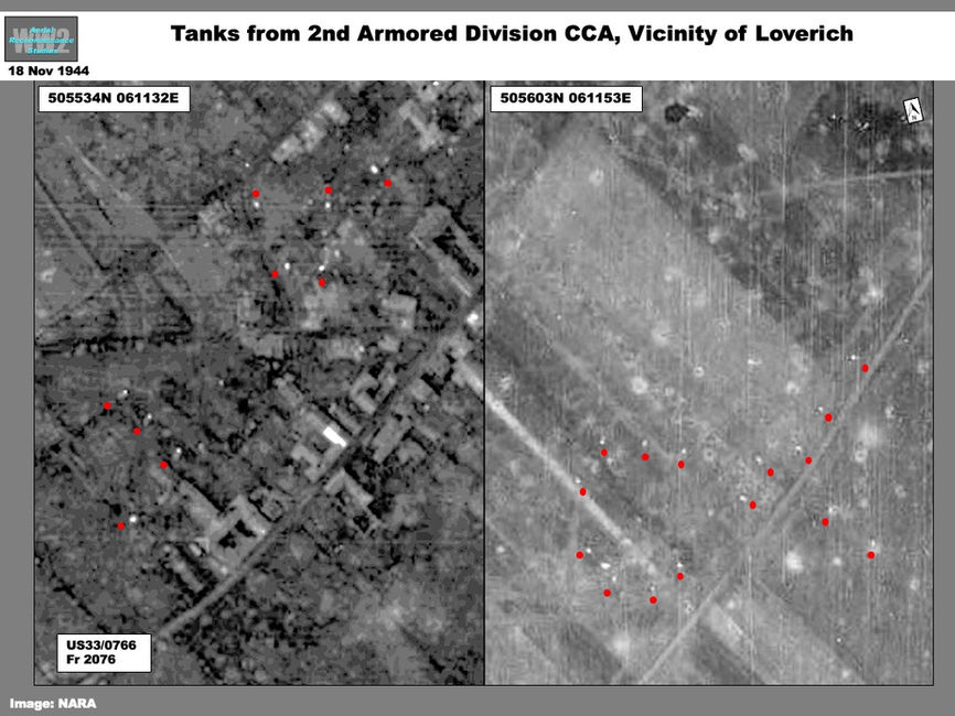
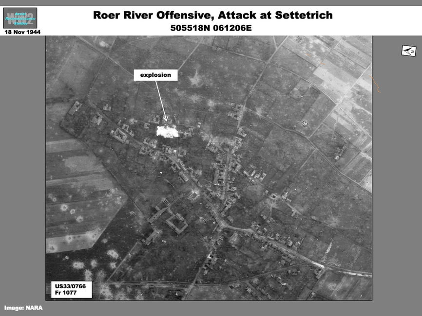
On 18 November the 116th Infantry Regiment with tank support made another attempt to approach Ederen and Gereonsweiler from the south by way of Setterich (Map). An attack from Puffendorf would be supported attached 747th Tank Battalion while another would be made by 2nd Armored Division CCA from Loverich. On the 18th probable elements of the two armored units were identified between Puffendorf and Loverich (Graphics). A total of 40 tanks were observed: 15 parked along the Loverich-Puffendorf road; 15 parked in Loverich; and 10 more in possible defensive formation 300 meters north of Setterich (Graphics). Fighting probably continued in Setterich, where an explosion could be seen in the center of the village (Graphic).
South Sector
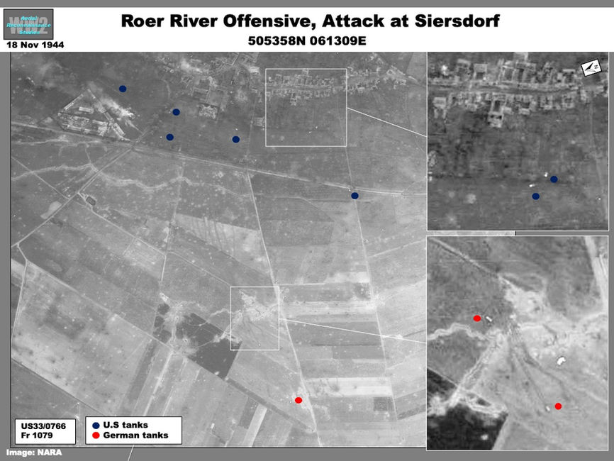
The 29th Infantry Division’s 115th and 175th Infantry Regiments supported by the 2nd Armored Division’s CCA were charged to take Siersdorf on the 17th. The Americans met stiff resistance, but coverage from the following day showed a second attack in progress: tanks had breached obstacles and were inside the village. Two disabled German tanks could be seen. (Graphic). A coal mine north of the village where German defenders made a stand on the 18th, was covered on19 November when the neighboring villages of Dürboslar and Schleiden were under attack (Graphic).
German Rear Areas
The 18 November imagery also covered the Roer River from the vicinity of Linnich to the village of Krauthausen, six kilometers southeast of Jülich where 15 vehicles --most headed southwest-- were passing over an intact road bridge. The main road bridge at Jülich had been destroyed by pre-offensive bombing but had possibly been repaired; another light road bridge was intact.
As the Americans approached the Roer in December, the Germans launched the Ardennes offensive, forcing postponement of operations, which did not occur until 8 February 1945 (Operation Lumberjack).
Information in this article comes from The European Theater of Operations: The Siegfried Line Campaign, Chapter XXII; The Roer River Offensive (pages 516-540); published by the U.S Department of Defense (1963).
