WW2 AERIAL RECON STUDIES
Facilities & Installations
German Radar and Electronics Test Facilities
Germany played a major role in the development radar and associated electronic systems. By the time the war started, the Luftwaffe and Kriegsmarine already had operational search, fire-direction and navigation/direction finding systems that became ever more sophisticated.
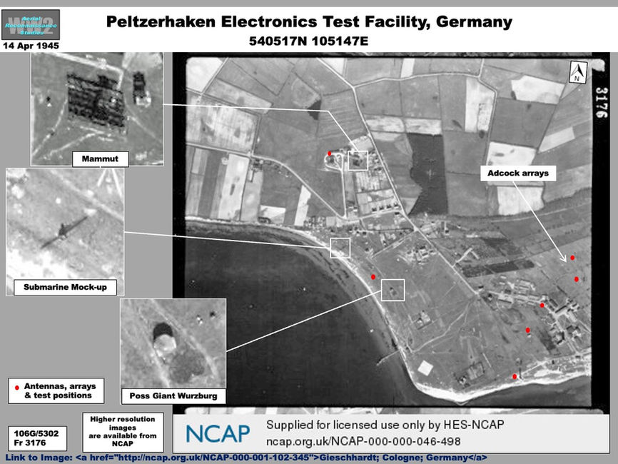
Germany’s first radar testing facility was set up for the Kriegsmarine at Pelzerhaken, on Lübeck Bay in 1935. By 1945 Pelzerhaken had grown into a large complex, a portion of which can be seen on an image from April 1945 (Graphic). The most clearly identifiable systems were a Mammut long-range coastal radar, a probable Giant Würzburg antenna on a building and several Adcock navigation/direction-finding arrays. Of interest was a submarine mockup used for testing radar reflective paint. A number of vans or vehicles could also be seen along the shore.
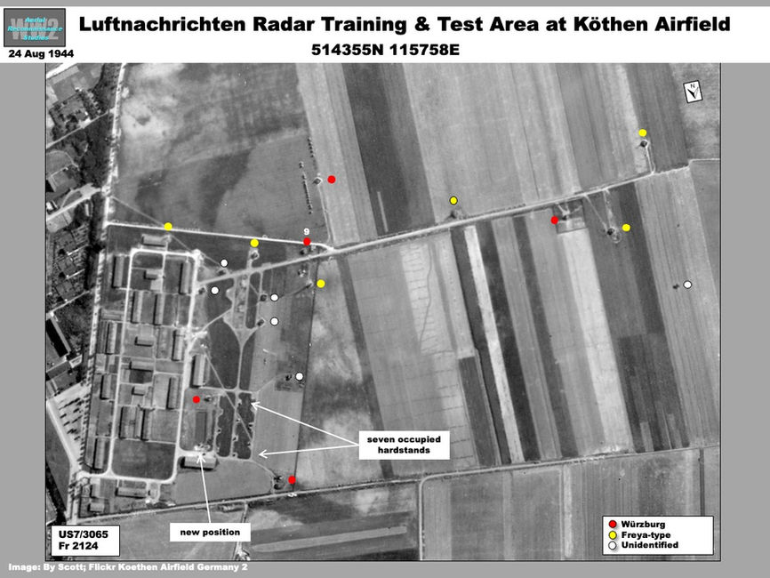
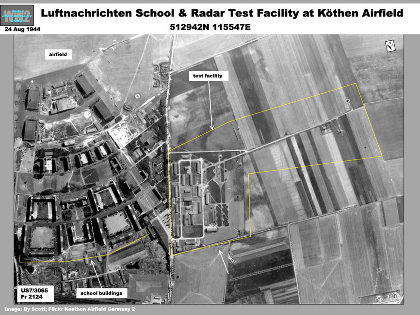
The Luftwaffe moved its radar and electronics testing efforts to a facility at Köthen Airfield southwest of Berlin. The facility was collocated with a Luftnachrichten radar operators’ school (Graphics). Imagery coverage from August 1944 shows the testing facility had a support area and more than 20 instrumentation positions. Approximately six Freya-type and five Würzburg-type radars, plus a number of other antennas could be identified.
The Lorenz company maintained a radar and electronic test facility at Dabendorf, near Zossen south of Berlin. Partial coverage of this facility in March 1945 shows it had a small support area with number of test positions, at least one with a radar (Graphic).
Another testing site at Horstfelde, just south of Dabendorf, is significant in being the deployment site of Germany’s most sophisticated radar, the Jagdhaus. Only two Jagdhaus radars were produced: one being destroyed and the other, deployed at Horstfelde, was used operationally as radar station Höckerschwan. The radar, on a circular building, was dismantled by the Soviets and removed for analysis. The building can still be seen. No good quality imagery of the area is available, but small-scale coverage from March 1945 shows the site (Graphic).


